Photos
|
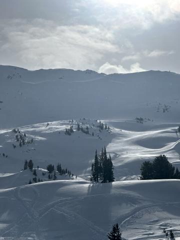
Cooke City, 2025-02-04 This is the N side of scotch bonnet, looks like a big break, didn’t get any closer than this however. Photo: S Strenge |
|
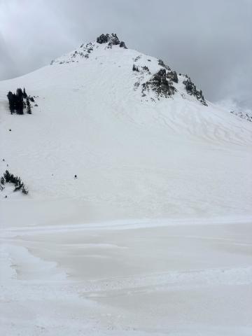
Cooke City, 2025-02-04 N face of crown butte, looks like it slid before the dirt event (we think the end of the storm yesterday/ or last night must have been dirty snow?). Photo: S Strenge Link to Avalanche Details |
|
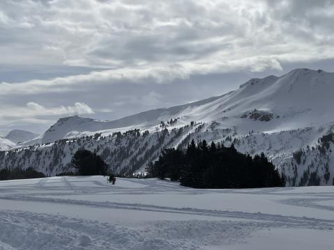
Cooke City, 2025-02-04 Avalanche east aspect of Henderson. This slid sometime between 11:30 - 12:30 on 2/4/24. Photo: BPG Link to Avalanche Details |
|
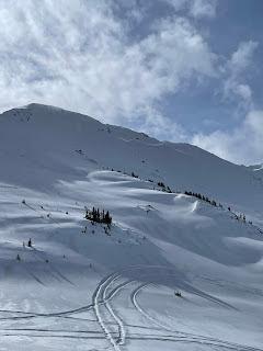
Cooke City, 2025-02-04 Avalanche on north aspect of Fisher Mountain. This likely slid sometime between 2/2-2/3. Photo: BPG Link to Avalanche Details |
|
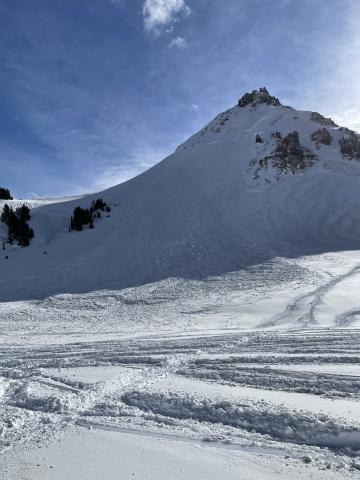
Cooke City, 2025-02-04 Avalanche north aspect of Crown Butte. This likely slid sometime between 2/2-2/3. Photo: BPG Link to Avalanche Details |

|
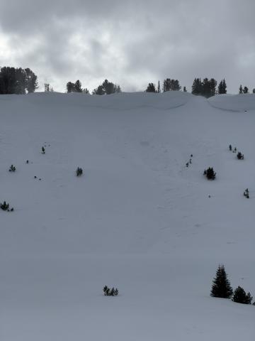
Northern Madison, 2025-02-04 On the headwall of the Second Yellow Mule, we saw two recent wind slab avalanches. These were small (R1 D1), immediately below the ridge, and likely broke late last night or this morning. Photo: GNFAC Link to Avalanche Details |
|
Northern Madison, 2025-02-04 On the headwall of the Second Yellow Mule, we saw two recent wind slab avalanches. These were small (R1 D1), immediately below the ridge, and likely broke late last night or this morning. Photo: GNFAC Link to Avalanche Details |

|
Northern Madison, 2025-02-04 Strong winds blew all day from the SW, sustaining 30mph at ridgelines. Snow was actively transported all day by winds, and plumes were visible on far away ridgelines and summits. Photo: GNFAC |
|
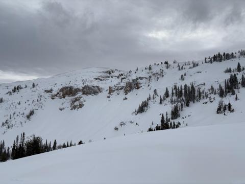
Lionhead Range, 2025-02-04 Plenty of wind slabs ranging in size on Lionhead ridge and on surrounding slopes. Photo: Riley |
|
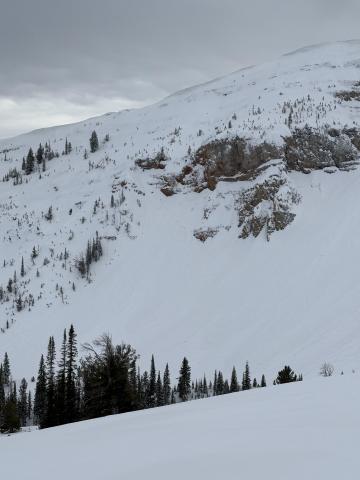
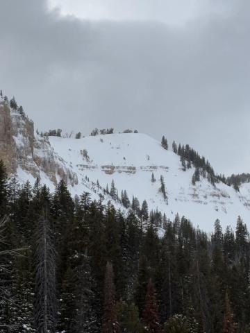
Lionhead Range, 2025-02-04 Plenty of wind slabs ranging in size on Lionhead ridge and on surrounding slopes. Photo: Riley |
|
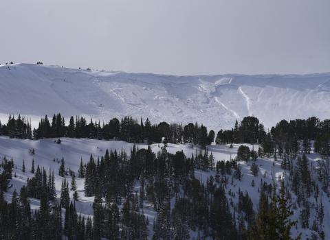
Lionhead Range, 2025-02-04 Plenty of wind slabs ranging in size on Lionhead ridge and on surrounding slopes. Photo: Riley |
|
Cooke City, 2025-02-04 Some recent avalanche activity noted on east Mt. Henderson. Photo: B Fredlund |

|
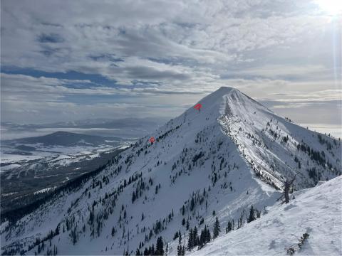
Cooke City, 2025-02-04 Some recent avalanche activity noted on Miller Ridge. Photo: B Fredlund |
|
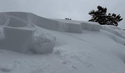
Bridger Range, 2025-02-04 Skier triggered wind slab avalanche on Saddle Peak. Photo: BBSP Link to Avalanche Details |
|
Northern Madison, 2025-02-04 This slab from my ski cut was about 20” deep and 60’ wide. It’s NE facing so pretty wind blown. Photo: S Budac |
|
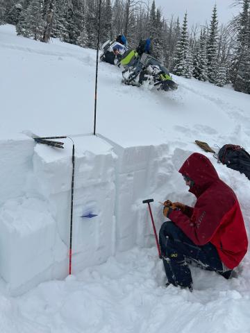
Southern Madison, 2025-02-02 Alex documenting the stratigraphy on a W aspect at 8850' near the Wilderness Boundary
|
|
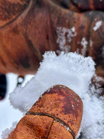
Southern Madison, 2025-02-02 On a north aspect at 9200 ft, there were 1mm facets chained together almost 10mm long.
|
|
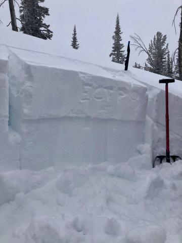
Southern Madison, 2025-02-02 A layer of nsf's and surface hoar was failing ~10 inches deep producing easy ECTP's
|
|
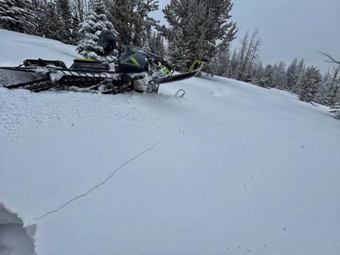
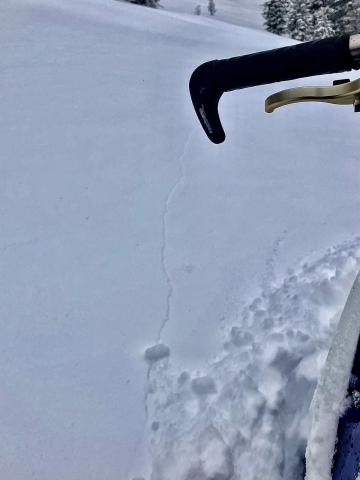
Southern Madison, 2025-02-02 A layer of nsf's and surface hoar was failing ~10 inches deep and causing shooting cracks
|
|
Southern Madison, 2025-02-02 A layer of nsf's and surface hoar was failing ~10 inches deep and causing shooting cracks
|
