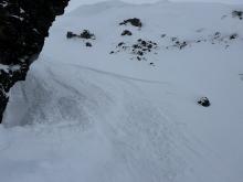
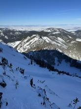
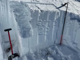
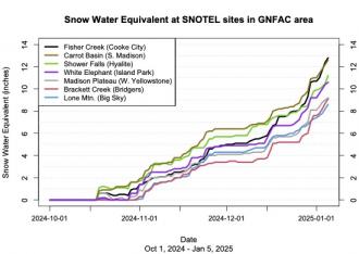
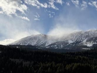
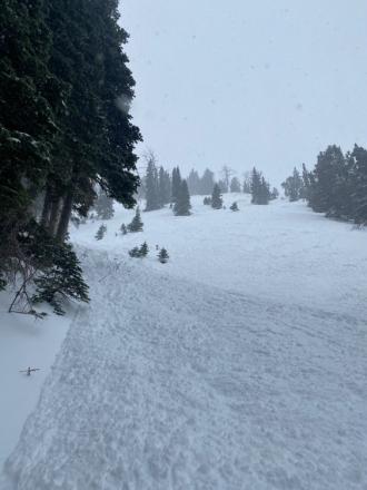
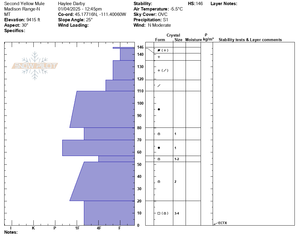
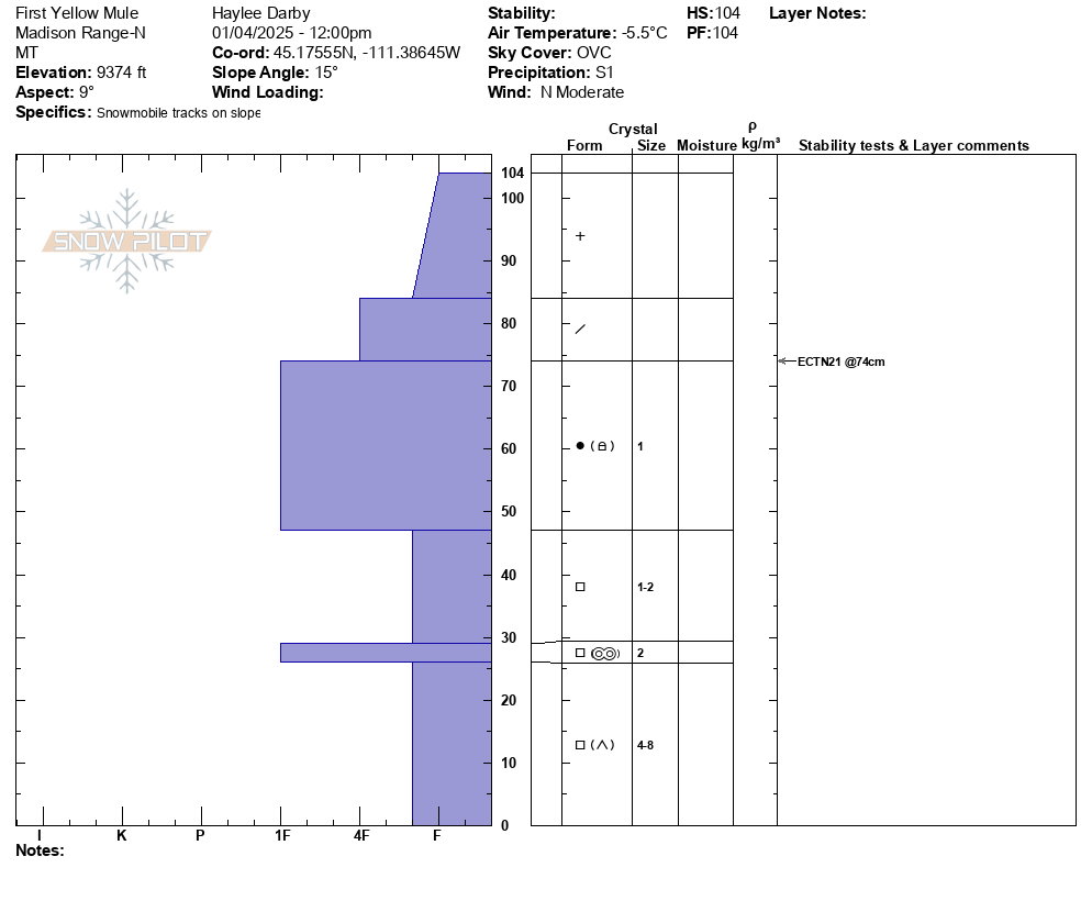
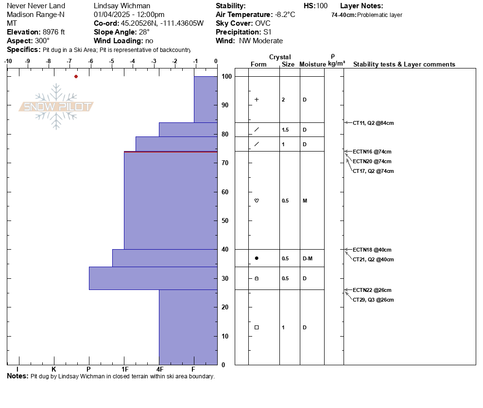
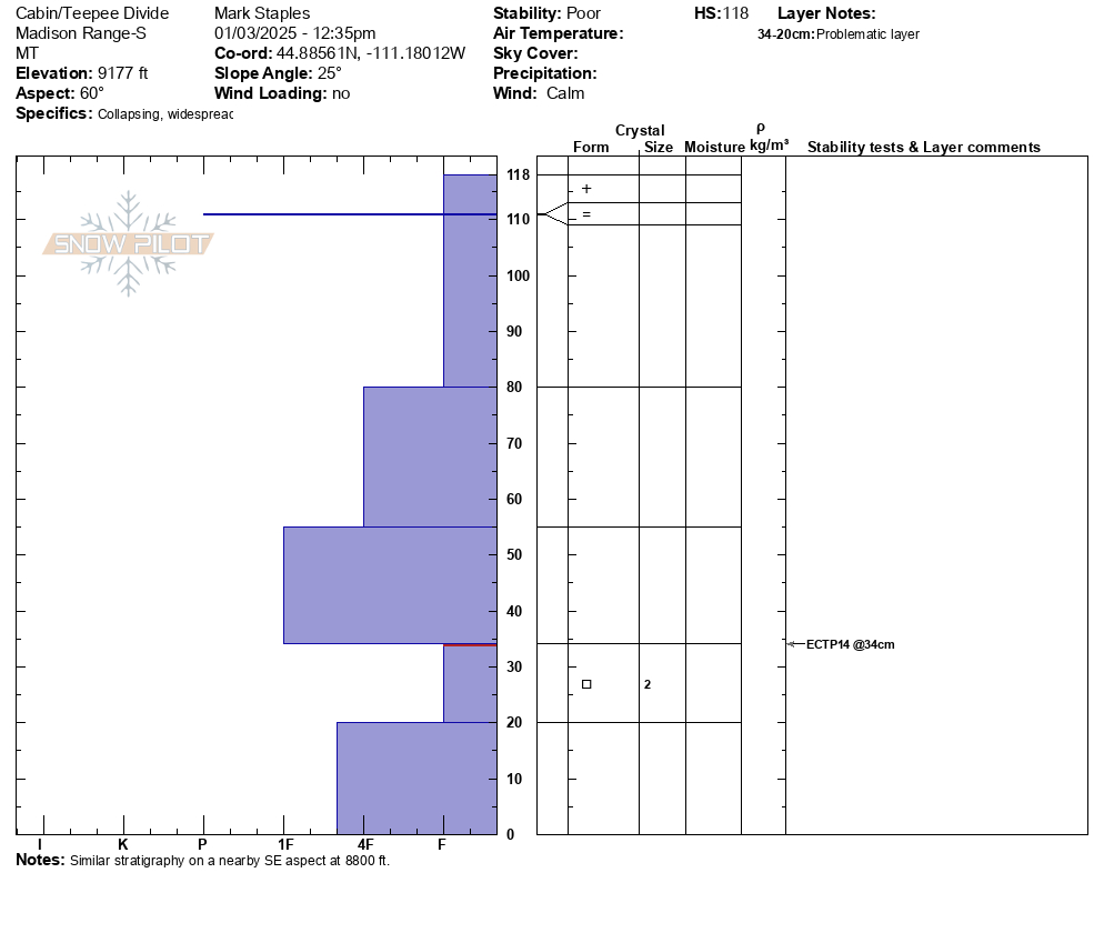
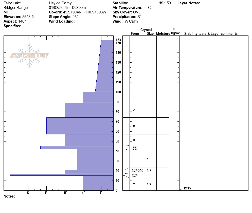
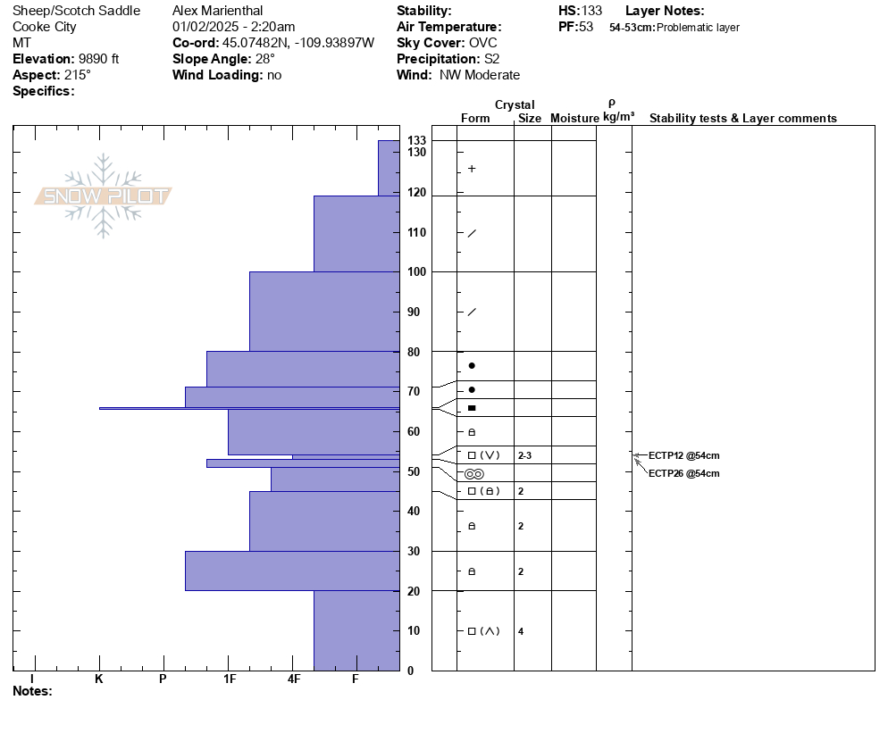
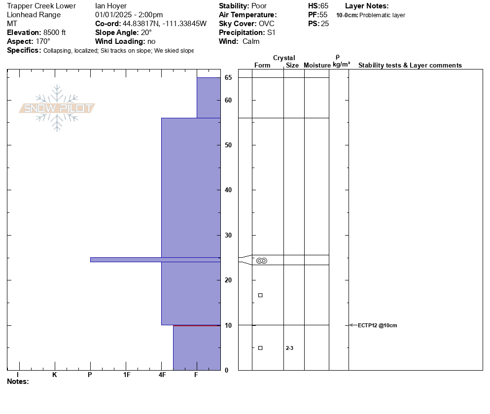
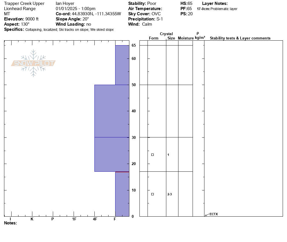
Today, we traveled into the Maid of the Mist basin and up and along the Palace Butte ridgeline. Although temperatures have warmed up significantly since the weekend, strong winds kept conditions frigid. Winds blew plumes of snow off the high peaks and at ridgelines, gusting 50-60 mph. Photo: GNFAC
Trip Planning for Northern Gallatin
Past 5 Days

Moderate

Moderate

Moderate

Moderate

Moderate
Relevant Avalanche Activity
R1-D1
Elevation: 9,800
Aspect: SE
Coordinates: 45.3934, -110.9690
Caught: 0 ; Buried: 0
From obs: "noted a recent natural wind slab avalanche below ridgeline on a SE aspect at 9800’. It was around 60’ wide and ranged from 2-6” deep. "
More Avalanche Details
SS-AS-R1-D1-I
Coordinates: 45.4164, -110.9700
Caught: 0 ; Buried: 0
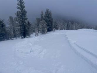
From obs. 1/19: "Wind was swirling in Maid of the Mist yesterday, mostly upslope winds that were transporting snow, but inconsistently and were difficult to predict where they were loading. We did not find widespread wind loading, but did get a very small windslab to release just below the top of the ridge (max 3-4" thickness, see image)."
More Avalanche Details
SS-N
Aspect: N
Coordinates: 45.4444, -111.0040
Caught: 0 ; Buried: 0
Observed a fresh slide on the north side of Mt Blackmore, crown was already filling in, but looked to be a foot or two deep in steep rocky terrain to the skiers left of the north couloir.
More Avalanche Details
Relevant Photos
-
-
Winds blew plumes of snow off the high peaks and at ridgelines, gusting 50-60 mph. Photo: GNFAC
-
Winds blew plumes of snow off the high peaks and at ridgelines, gusting 50-60 mph. Photo: GNFAC
-
From Obs. "Wind was swirling in Maid of the Mist yesterday, mostly upslope winds that were transporting snow, but inconsistently and were difficult to predict where they were loading. We did not find widespread wind loading, but did get a very small windslab to release just below the top of the ridge (max 3-4" thickness, see image)." Photo: C. Avis
-
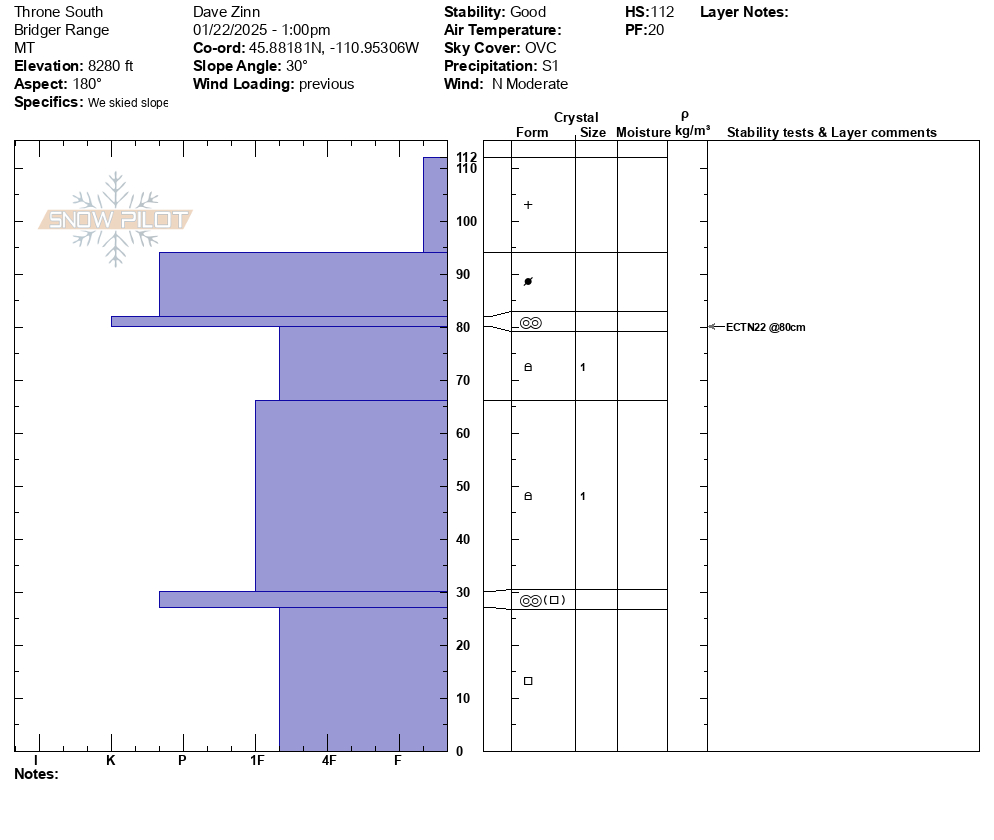
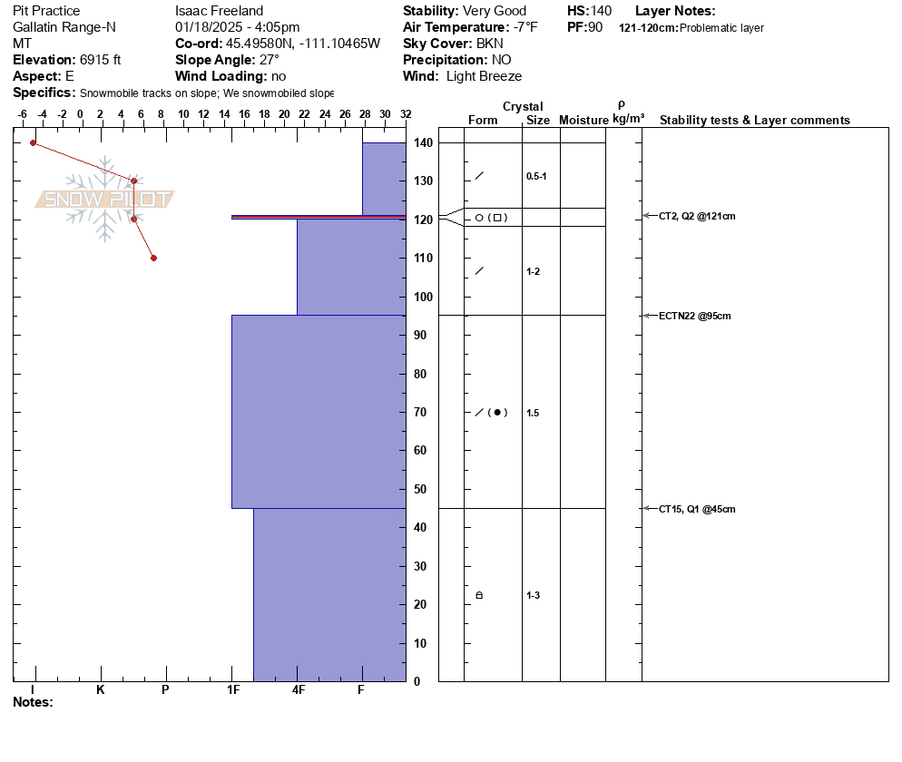
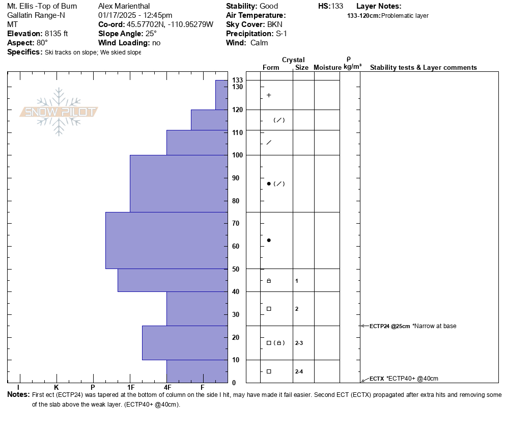
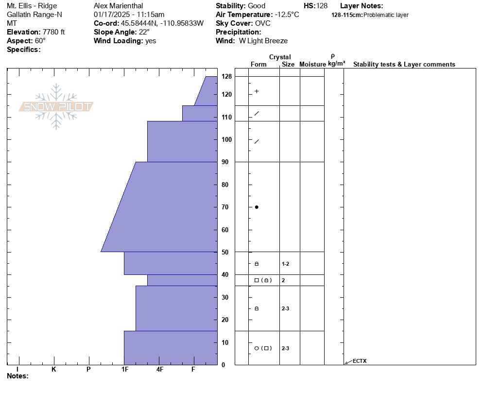
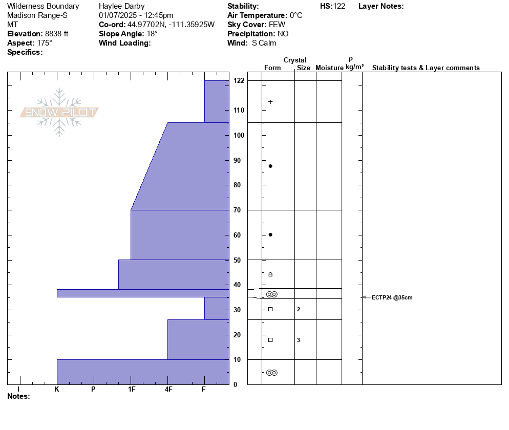
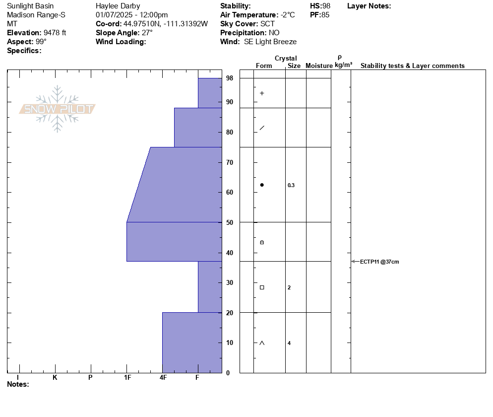
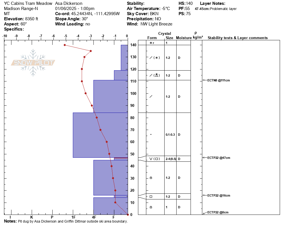
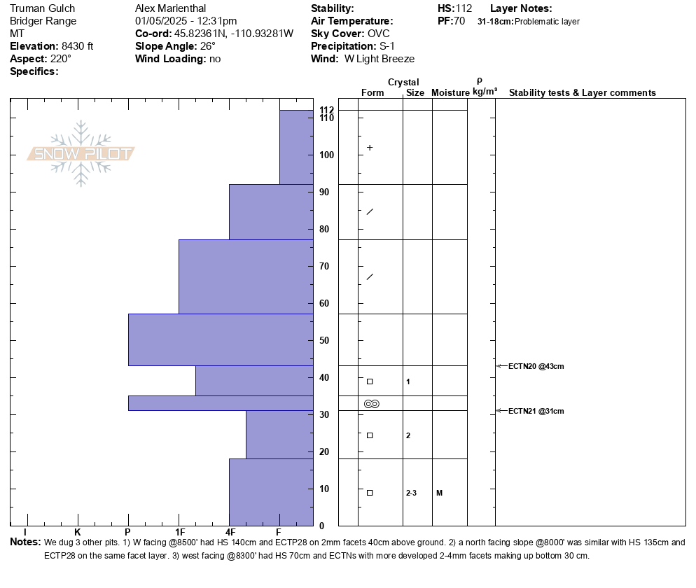
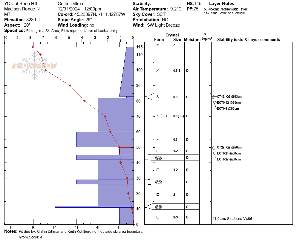
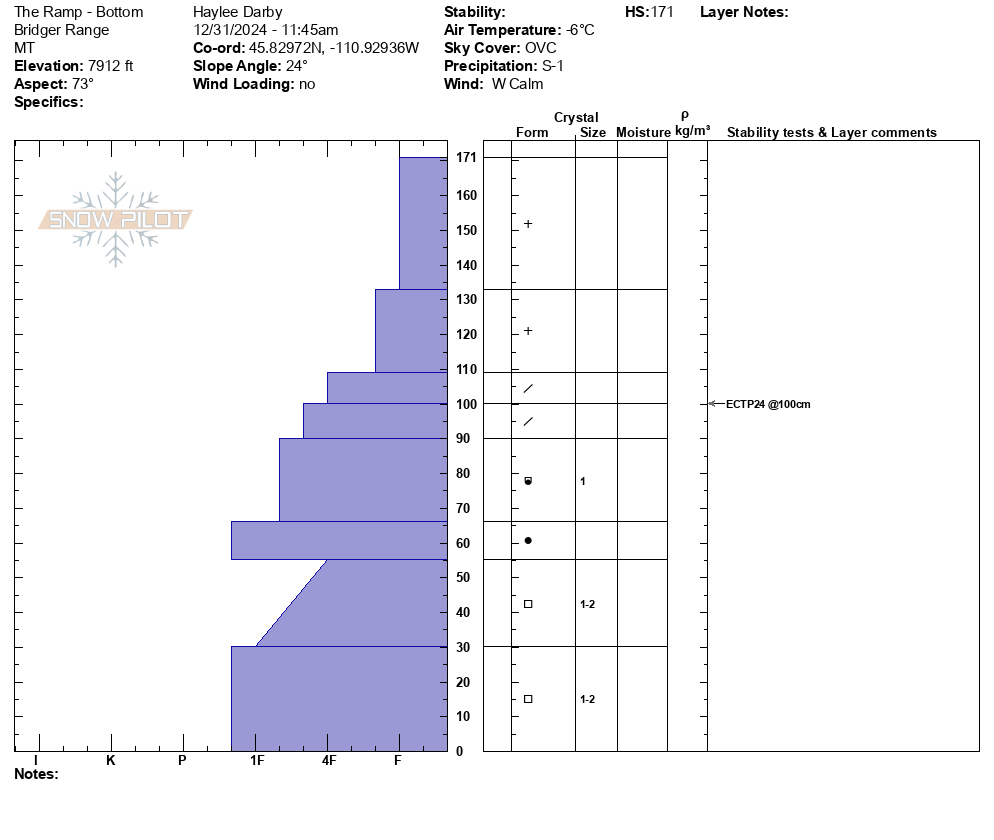
We skied to the top of Mt. Ellis via the ridge from the north. There was light wind on the ridge, otherwise calm. Snowing steadily this morning and tapered off by noon-1pm with skies clearing after noon. There were 2-4" of low density new snow. We dug a pit off the ridgeline on a northeast facing slope at 7,800' and one pit at the top of the burned slope, east facing at 8,100'. Profiles attached.
The first pit had an ECTX and the second had propagation with extra force. There were 2mm facets 30cm off the ground in both pits which were slightly softer in the higher pit. Snow depth was 3-4 feet up high and around 2 feet lower in the thicker trees and along the trails.
-
Observed a fresh slide on the north side of Mt Blackmore, crown was already filling in, but looked to be a foot or two deep in steep rocky terrain to the skiers left of the north couloir. Photo: S Jonas
-
Lots of snow moving around in Hyalite this morning! Strong winds were moving snow at/above treeline, Lee aspects getting loaded. Photo S Jonas
-
Saw cracking of cornices on the ridgeline NE of Mount Blackmore. Just a little nudge released a significant portion. Photo: T Miller
-
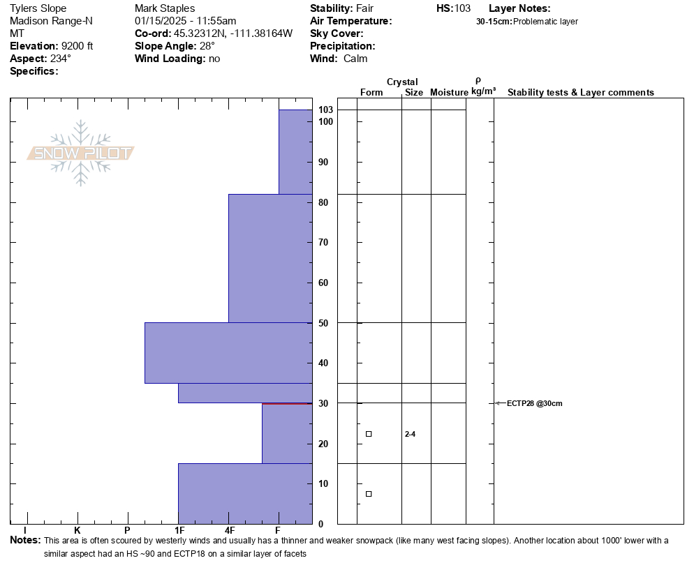
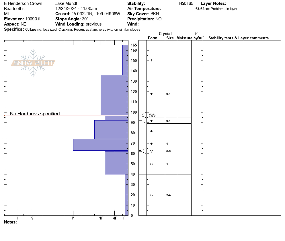
Snowpit from the top of Tyler's slope in Beehive Basin, W facing, 9200 ft. This is representative of an area with thin snow that is weaker
-
Probably already reported...but touchy storm slabs on Mt Blackmore. Attached is a photo of a natural from the approach, at the switchbacks to the upper basin.
Photo: Anonymous
-
Wind slab Blackmore south bowl - 10 Jan 2025
-
Wind slab along Blackmore trail. Good clue before we got above treeline where more wind was blowing and moving snow
-
We triggered this wind slab by triggering a smaller one above it while descending the NE ridge of Blackmore.
~10-12" deep and 25' wide -
Big wind slab on N face of Mt Blackmore. We watched it cut loose at 14:25 from cornice fall.
Good news is that it didn't trigger a deeper slide.
-
Snow on a post along the Blackmore trail shows how much snow has been falling. I suspect the slow and steady nature of snowfall is what allowed it to do this.
-
Storm slab avalanche that broke about 400 ft wide at 9200 ft in a ENE facing sub-cirque of Blackmore
-
Two storm slab avalanches on the east face of Blackmore 8-10 inches deep. One of them ran down the normal skin track.
-
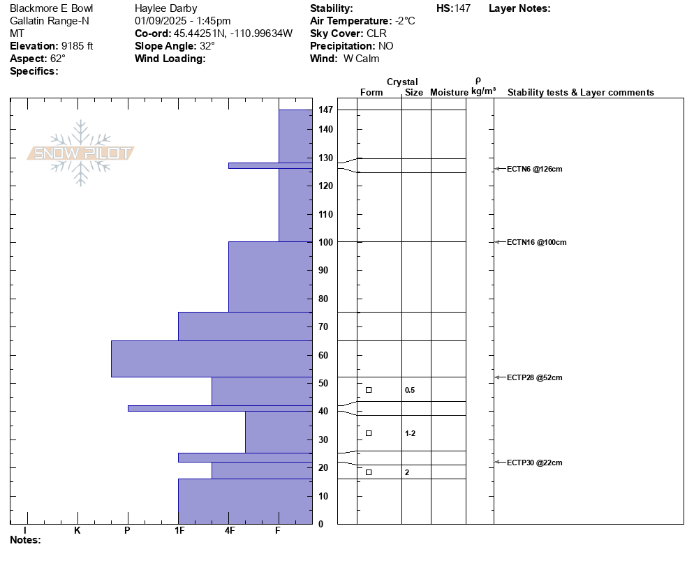
image of snowpit from Mt Blackmore, NE facing, 9185', HS almost 5 ft
-
Skiers in the Main Fork of Hyalite Creek drainage spotted this crown below the upper cliffs on the Maid of the Mist. Photo: Anonymous
-
-
The one thing of note was a recent avalanche on the north face of Blackmore. Visibility was poor but it was a small pocket in a steep, rocky zone that broke near the ground. Photo: H Darby
-
Small cornice build up on lee aspects from north winds. Photo: H Darby
-
There was recent avalanche on the north face of Blackmore. Visibility was poor but it was a small pocket in a steep, rocky zone that broke near the ground. Photo: H. Darby
-
Around 7 p.m. Monday night, a few miles up Portal Creek, triggered from bottom of slope.
-
Around 7 p.m. Monday night, a few miles up Portal Creek, triggered from bottom of slope.
-
Small wind slab in hyalite at the start to champaign slot, 7600’, WNW, ~8” crown. Photo: S Bonucci
-
Small wind slab in hyalite at the start to champaign slot, 7600’, WNW, ~8” crown. Photo: S Bonucci
-
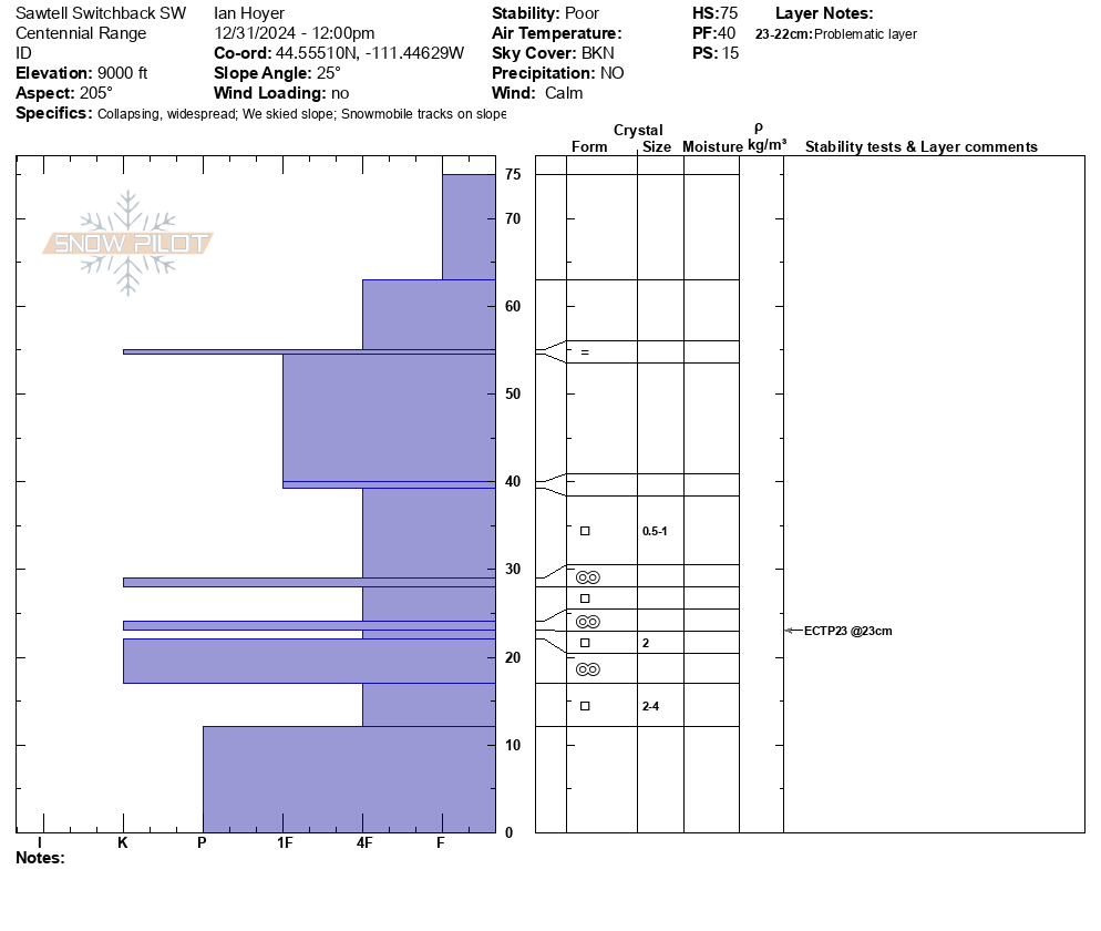
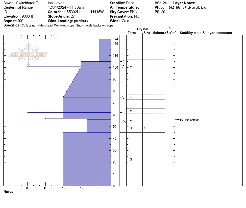
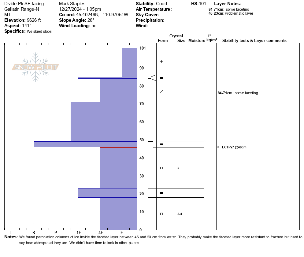
Divide Pk 9600ft SE facing snowpit on 27 Dec 2024 with ECTP27 and ECTP23 at 22" deep
-
Divide Pk 9560ft E facing snowpit, ECTP30 about 24" deep on 27 Dec 2024
-
Above 9000’ winds were actively loading the snow and I got cracking and a very small slab to release on a small wind drifted roll over at 9500’ on a N aspect. Photo: E Heiman
-
There was some natural avalanche activity on the peak south of mt Bole. Photo: Anonymous
-
Observed from Flanders this morning. Presumed recent natural slide around ~9950 ft. on a E/NE aspect. Photo: E Webb
-
The power of the winds was emphasized by the scoured west side of the East Ridge of the Main Fork. Photo: E Webb
-
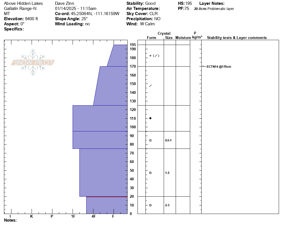
I dug a pit on the SE shoulder of divide at around 9600’ and got a ECTP 14 on the persistent weak created during the long dry spell layer buried from this weeks storms. Photo: Anonymous
-
Plumes of drifting snow in the Bridger Range as strong winds blasted the mountains. Photo: GNFAC
-
From IG: On 12/15 "Storm slab broke about 200’ above us as skinning up the hallway coming from the north side on the throne." Photo: Anonymous
-
Photo: B Durrum
-
Photo: M. Legler
-
Gusty winds transporting snow in Taylor Fork on Saturday. Triggered a 4-5 inch deep wind slab that propagated about 50 ft at the top of a north east facing slope at 9,500 ft.
Photo: JP
-
Ice gullies snowpack
Photo: GNFAC
Videos- Northern Gallatin
WebCams
Bozeman Pass, Looking SE
Weather Stations- Northern Gallatin
Weather Forecast Northern Gallatin
Extended Forecast for14 Miles SE Gallatin Gateway MT
Cold Weather Advisory January 26, 12:00am until January 26, 11:00amWinter Weather Advisory January 24, 02:06pm until January 24, 08:00pmClick here for hazard details and duration Cold Weather Advisory Winter Weather Advisory-
Winter Weather Advisory January 24, 02:06pm until January 24, 08:00pm
NOW until 8:00pm Fri

Winter Weather Advisory
This Afternoon

High: 14 °F
Snow
Tonight
Low: -3 °F
Snow then
Mostly CloudySaturday

High: 8 °F
Partly Sunny
Saturday Night

Low: -4 °F
Mostly Clear
Sunday

High: 20 °F
Sunny
Sunday Night

Low: 9 °F
Mostly Clear
Monday

High: 29 °F
Sunny
Monday Night

Low: 17 °F
Mostly Clear
The Last Word
Thank you for sharing observations. Please let us know about avalanches, weather or signs of instability via the form on our website, or you can email us at mtavalanche@gmail.com, or call the office phone at 406-587-6984.


